Mynd:Eastern Mediterranean basins including Levent basin and oil and gas fields.png
Jump to navigation
Jump to search

Stærð þessarar forskoðunar: 776 × 599 mynddílar Aðrar upplausnir: 311 × 240 mynddílar | 621 × 480 mynddílar | 777 × 600 mynddílar | 932 × 720 mynddílar.
Upphafleg skrá (932 × 720 mynddílar, skráarstærð: 243 KB, MIME-gerð: image/png)
| Lýsing |
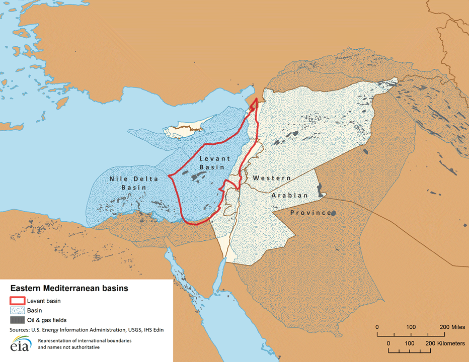
English: Cf. original legend: "Eastern Mediterranean basins" |
|||
| Dagsetning | ||||
| Uppruni | http://www.eia.gov/countries/analysisbriefs/Eastern_Mediterranean/images/basin_map.png | |||
| Höfundarréttarhafi | U.S. Energy Information Administration (eia) | |||
| Réttindi (Endurnotkun á þessari skrá) |
|

source publication: "Eastern Mediterranean Region" (pdf), U.S. Energy Information Administration (eia), full report, Last updated: 15 August 2013, 29 pp.
Breytingaskrá skjals
Smelltu á dagsetningu eða tímasetningu til að sjá hvernig hún leit þá út.
| Dagsetning/Tími | Smámynd | Víddir | Notandi | Athugasemd | |
|---|---|---|---|---|---|
| núverandi | 4. september 2014 kl. 13:17 | | 932 × 720 (243 KB) | Anglo-Araneophilus~commonswiki | {{Information |Description ={{en|1=Cf. original legend: "Eastern Mediterranean basins"}} |Source =http://www.eia.gov/countries/analysisbriefs/Eastern_Mediterranean/images/basin_map.png |Author =U.S. Energy Information Administration... |
Skráartenglar
Eftirfarandi síða notar þessa skrá: