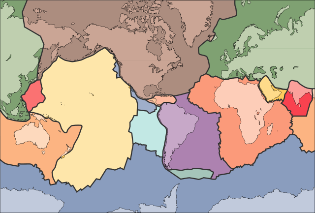
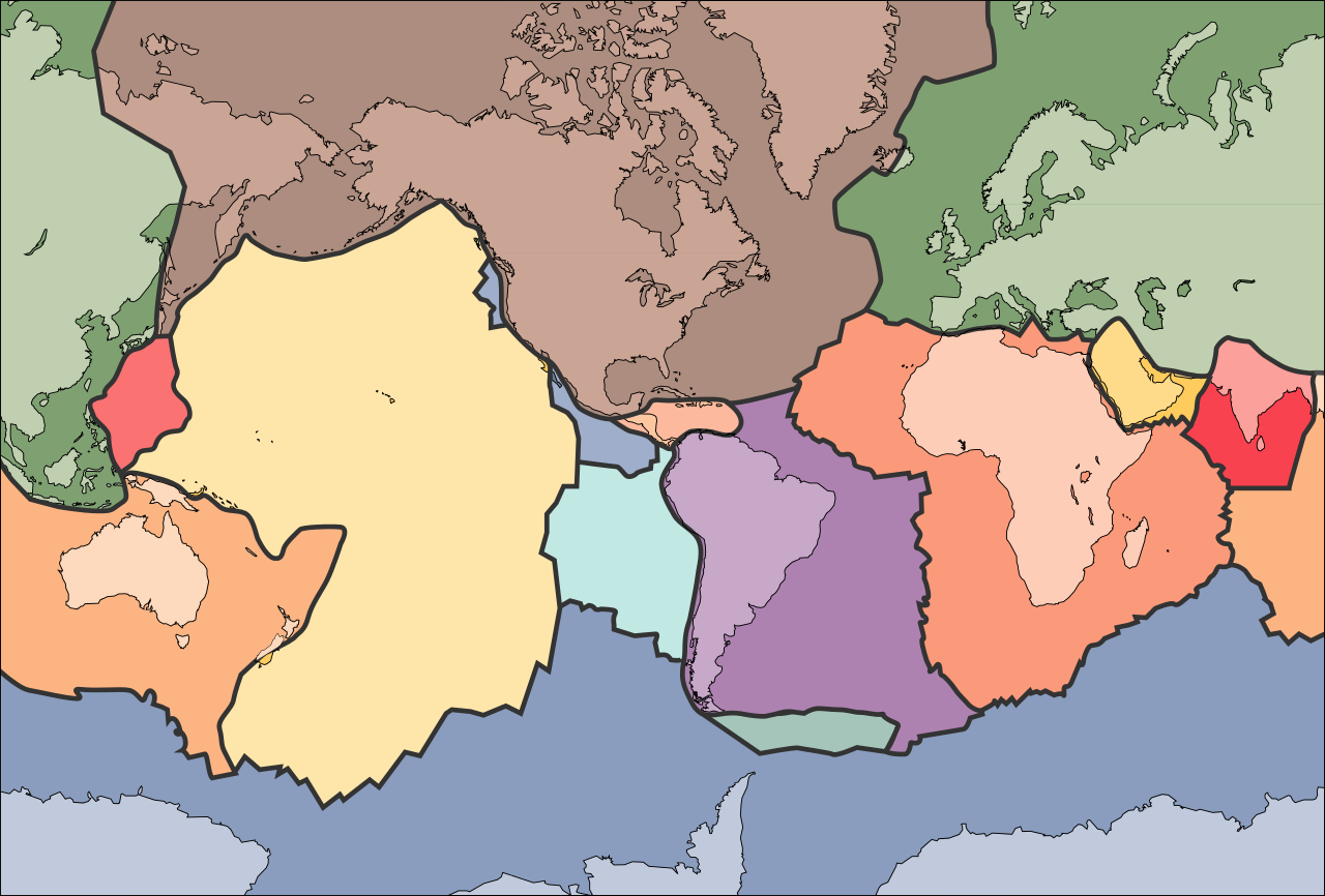
Mynd:Tectonic plates (empty).svg
Jump to navigation
Jump to search


Stærð þessarar PNG forskoðunar á SVG skránni: 681 × 461 mynddílar. Aðrar upplausnir: 320 × 217 mynddílar | 640 × 433 mynddílar | 800 × 542 mynddílar | 1.024 × 693 mynddílar | 1.280 × 866 mynddílar.
Upphafleg skrá (SVG-skrá, að nafni til 681 × 461 mynddílar, skráarstærð: 356 KB)
الخلافه الرشيديهkp
Lýsing
| Lýsing | |
| Dagsetning | 10. september 2005 (upload date) |
| Uppruni | File:Tectonic plates (empty).png |
| Höfundarréttarhafi | Ævar Arnfjörð Bjarmason |
| Aðrar útgáfur |
This file was derived from: Tectonic plates (empty).png:
[]
|
| SVG genesis | This W3C-invalid map was created with Adobe Illustrator, and with Inkscape. |


.png)


.svg)
.png)
Leyfisupplýsingar:
This image is in the public domain in the United States because it only contains materials that originally came from the United States Geological Survey, an agency of the United States Department of the Interior. For more information, see the official USGS copyright policy.
|
Breytingaskrá skjals
Smelltu á dagsetningu eða tímasetningu til að sjá hvernig hún leit þá út.
| Dagsetning/Tími | Smámynd | Víddir | Notandi | Athugasemd | |
|---|---|---|---|---|---|
| núverandi | 11. október 2006 kl. 02:04 | | 681 × 461 (356 KB) | Sting | Borders correction integrated to the continents borders; size of picture |
.svg)