Mynd:2015-11-29 11-28-41 course-des-forts-meroux 02.jpg
Jump to navigation
Jump to search


Stærð þessarar forskoðunar: 800 × 533 mynddílar Aðrar upplausnir: 320 × 213 mynddílar | 640 × 427 mynddílar | 1.024 × 682 mynddílar | 1.280 × 853 mynddílar | 4.000 × 2.666 mynddílar.
Upphafleg skrá (4.000 × 2.666 mynddílar, skráarstærð: 3,54 MB, MIME-gerð: image/jpeg)
Lýsing
| Lýsing |
This file was uploaded with Commonist.
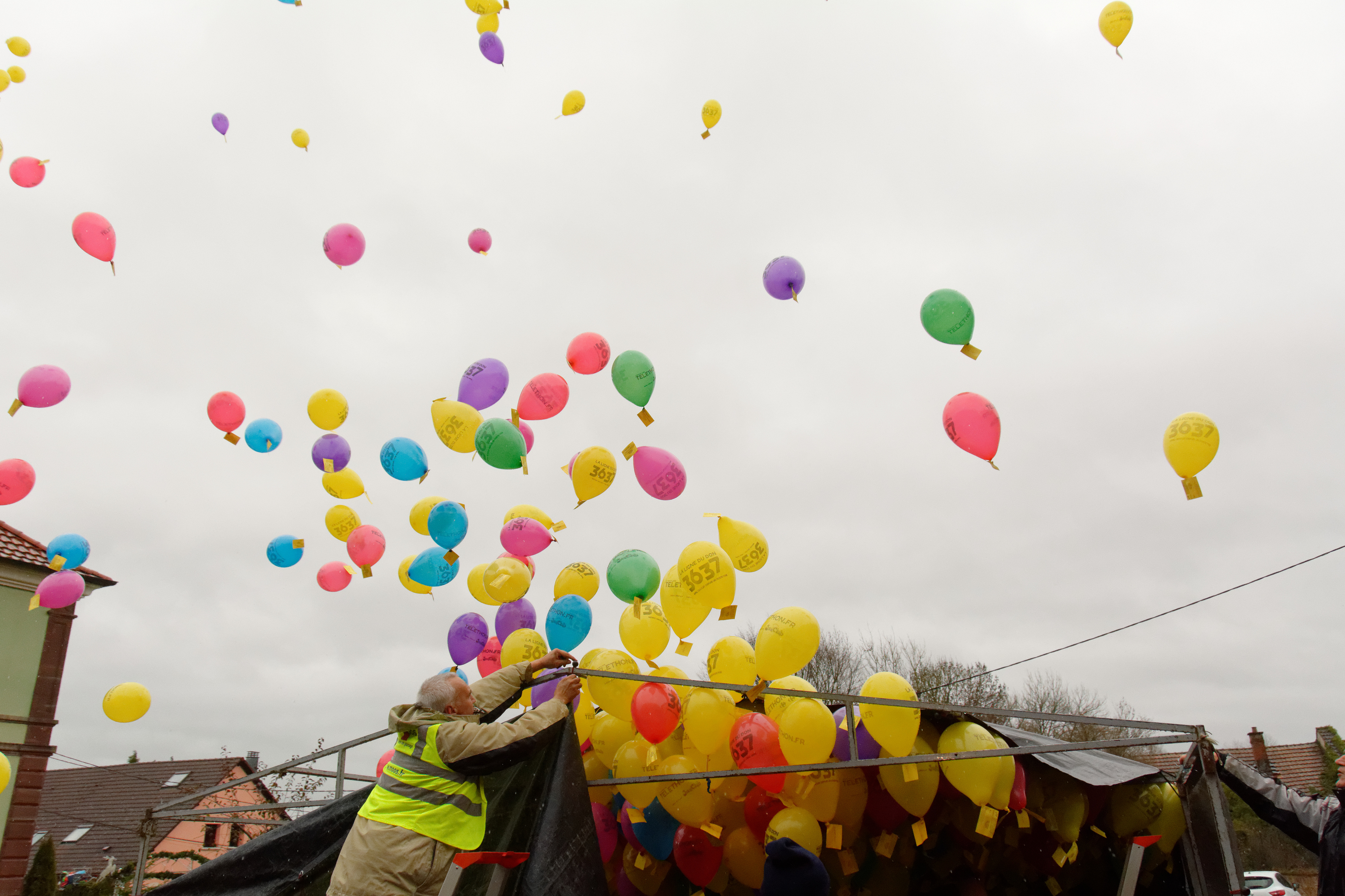
Course des Forts 2015 : départ à Meroux. La "Course des forts" est une course à pied organisée par les communes de Meroux et de Moval au profit du Téléthon. Les horaires sont :
|
||||||||||||||||||||||
| Dagsetning | |||||||||||||||||||||||
| Uppruni | eigin skrá | ||||||||||||||||||||||
| Höfundarréttarhafi |
|
||||||||||||||||||||||


| Camera location | | View this and other nearby images on: OpenStreetMap |
|---|
Leyfisupplýsingar:
This file is licensed under the Creative Commons Attribution-Share Alike 4.0 International license.
- Þér er frjálst:
- að deila – að afrita, deila og yfirfæra verkið
- að blanda – að breyta verkinu
- Undir eftirfarandi skilmálum:
- tilvísun höfundarréttar – Þú verður að tilgreina viðurkenningu á höfundarréttindum, gefa upp tengil á notkunarleyfið og gefa til kynna ef breytingar hafa verið gerðar. Þú getur gert þetta á einhvern ásættanlegan máta, en ekki á nokkurn þann hátt sem bendi til þess að leyfisveitandinn styðji þig eða notkun þína á verkinu.
- Deila eins – Ef þú breytir, yfirfærir eða byggir á þessu efni, þá mátt þú eingöngu dreifa því verki með sama eða svipuðu leyfi og upprunalega verkið er með.
Breytingaskrá skjals
Smelltu á dagsetningu eða tímasetningu til að sjá hvernig hún leit þá út.
| Dagsetning/Tími | Smámynd | Víddir | Notandi | Athugasemd | |
|---|---|---|---|---|---|
| núverandi | 30. nóvember 2015 kl. 08:41 | | 4.000 × 2.666 (3,54 MB) | ComputerHotline |
Skráartenglar
Eftirfarandi síða notar þessa skrá: