Mynd:WVirginiaCo.png
Jump to navigation
Jump to search

Stærð þessarar forskoðunar: 703 × 599 mynddílar Aðrar upplausnir: 282 × 240 mynddílar | 563 × 480 mynddílar | 704 × 600 mynddílar | 901 × 768 mynddílar | 1.201 × 1.024 mynddílar | 2.307 × 1.967 mynddílar.
Upphafleg skrá (2.307 × 1.967 mynddílar, skráarstærð: 1,86 MB, MIME-gerð: image/png)
Lýsing
| Lýsing |
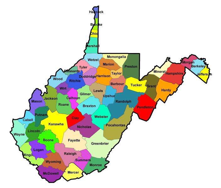
English: Map of the Counties in West Virginia. |
| Dagsetning | 22. apríl 2008 (original upload date) |
| Uppruni | eigin skrá (Original text: self-made) |
| Höfundarréttarhafi | Jm0371 (talk) / Jm0371 at enska Wikipedia |
Leyfisupplýsingar:
| This work has been released into the public domain by its author, Jm0371 at enska Wikipedia. This applies worldwide. In some countries this may not be legally possible; if so: Jm0371 grants anyone the right to use this work for any purpose, without any conditions, unless such conditions are required by law. |
Original upload log
Transferred from en.wikipedia to Commons by C messier using CommonsHelper.
The original description page was here. All following user names refer to en.wikipedia.
- 2008-04-22 19:23 Jm0371 2307×1967× (1953697 bytes) {{Information |Description= |Source=self-made |Date= |Author=~~~ |other_versions= }}
Breytingaskrá skjals
Smelltu á dagsetningu eða tímasetningu til að sjá hvernig hún leit þá út.
| Dagsetning/Tími | Smámynd | Víddir | Notandi | Athugasemd | |
|---|---|---|---|---|---|
| núverandi | 25. desember 2013 kl. 23:38 | | 2.307 × 1.967 (1,86 MB) | File Upload Bot (Magnus Manske) | Transfered from en.wikipedia by User:C messier using CommonsHelper |
Skráartenglar
Eftirfarandi síða notar þessa skrá: